Mapmaker(s): Minister X
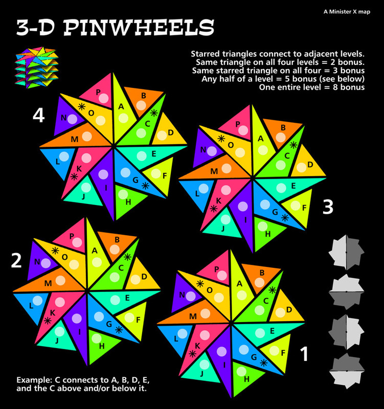
Number of Territories: 64
Special Features: none
What Makes This Map Worthy of Being Made: Intriguing and unique geometry/geography.
Map Image:
- Click image to enlarge.

At one time I tried (unsuccessfully) to get a few maps accepted here but it's been a long time and I've forgotten most of the rules and processes and would appreciate the mentoring of anyone who thinks this map shows promise and can help me. I used to know how to code the whddayacallit but that skill has long since eroded and I'd need a willing coder/partner. It should be pretty easy since it's a simple map with a lot of repetition.
I see that there are seven Beta maps but only one added in the last three years. Is the site even still actively seeking new designs? If not, that's cool. There are plenty of maps here. If so, does this have even a remote chance of meriting refinement? I'm sure it could stand quite a bit. For starters the bonus amounts are just initial estimates and I'm not sure the white circles are needed.
Thank-you.