
Moderator: Cartographers

Haydena wrote:8 Continents is a bit much. And that background, that looks to be the same one Rev. Kyle used in his Antartica map, and it certainly doesn't fit a map of India.

gavin_sidhu wrote:reverend_kyle wrote:what happened to your Australia map with Jas IN Orbit?
Thats Jas_in_Obits map, not mine. I just want him/her to finish it so i can play it (Im from Australia)

P.s. To Andy, can you organise a map-making 101, i think it would be really useful for all the nube map-makers out there. thnx
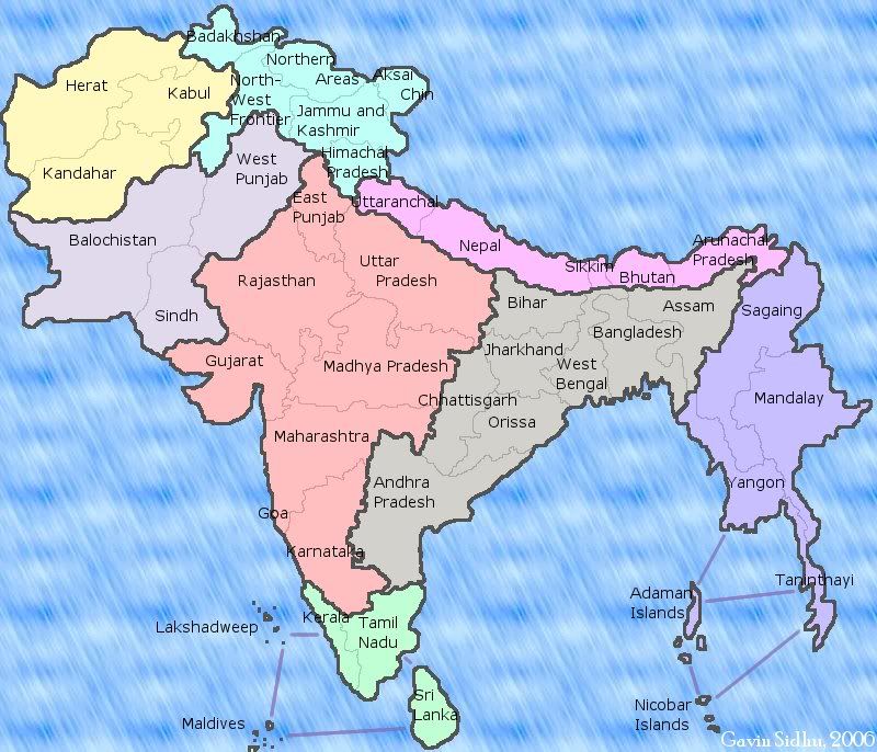
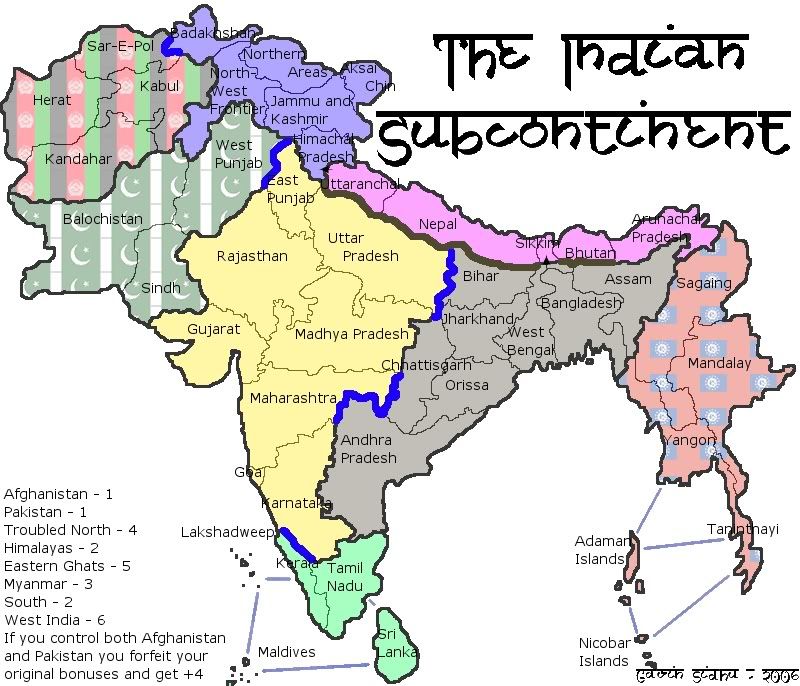
reverend_kyle wrote:How accurate is the drawing to that of India, because on second thought I'm not sure how close that is..
gavin_sidhu wrote:reverend_kyle wrote:I'm talking the overall shape in general....;It doesnt seem like India is really shaped like that.. I could be wrong..
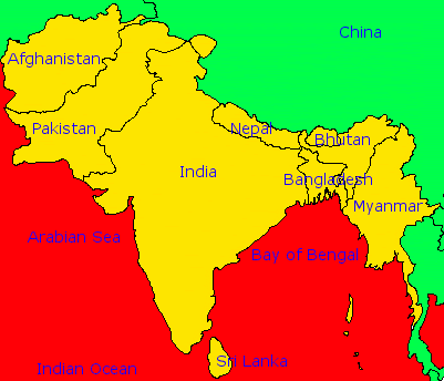
This was the original picture i used
The cropped version is this:
Yellow is the area im doing, red is the sea and green is other countries.[/img][/list]

gavin_sidhu wrote:There are 43 countries (I know it should be 42, but i cant find a country to get rid of or combine).
fluffybunnykins Posted: 13 Jul 2006 17:51 Post subject:
--------------------------------------------------------------------------------
is there anything more imaginative to call 'northern areas' or is that just how it is refered to?


 Children, this is what happens to hockey players, druggies, and Hillary Clinton.