Haiti [Quenched]

Care to peruse completed maps? Take a stroll through the Atlas.

Moderator: Cartographers

Forum rules
Please read the Community Guidelines before posting.
User avatar
oaktown
Posts: 4451
Joined: Sun Dec 03, 2006 9:24 pm
Location: majorcommand

Re: Haiti v4 pg3

Post by oaktown »

cairnswk wrote:3. i like the overall appearance....it is clean and crisp,,,,even though some have suggested a little bright, but on a map like this bright can be toned down a tad and still retain a sub-tropical flavour.
4. just some attention to differentation between border thickneses and rivers need to be made clearer.

I think the bright colors are fine if it works with the overall theme of the map. Right now it doesn't - some of your colors are a bit dreary, e.g. the sea and the legend. I would also suggest you remove black from the palette entirely - maybe come up with something lighter and friendlier for the borders and text. A dark green, brown, or blue will have the same effect as black if it is used against the right background, without being as heavy (though maybe not blue, because you already have the blue rivers).

The rivers were my first concern in looking at this map. In some places you break up in impassable river with a black border, while in other places you have a bridge. What's the difference? And you'll need to work out the Lac de Peligre/La Finca border - it is so small I can't tell if it's impassable... or that it's a border at all. You can take some liberties with geography there.

And I agree with Cairnswk (again) that the dots seem wrong for this map... maybe something more fun and tropical, like a boat!
Image
User avatar
edbeard
Posts: 2501
Joined: Thu Mar 29, 2007 12:41 am

Re: Haiti v6 pg6

Post by edbeard »

[bigimg]http://i140.photobucket.com/albums/r4/runthemover/haitiv6.png[/bigimg]


http://i140.photobucket.com/albums/r4/runthemover/haitiv5.png
v4
v3
v2
v1

What you need to know:

1. 28 territories
2. 6 continents

Changes in this update
1. border colours changed
2. territory label text colour changed
3. army circle colours changed
4. water route colour changed
5. Nord continent colour toned down
6. fixed Manneville - Bouli border (made into bridge).


To Do:

1. Gameplay / Bonus Discussion
2. finalize colours

Points of Discussion:

oaktown wrote:In some places you break up in impassable river with a black border, while in other places you have a bridge. What's the difference? And you'll need to work out the Lac de Peligre/La Finca border - it is so small I can't tell if it's impassable... or that it's a border at all. You can take some liberties with geography there.

And I agree with Cairnswk (again) that the dots seem wrong for this map... maybe something more fun and tropical, like a boat!


I fixed the Manneville - Bouli one since I found evidence that was a full river.

The other one is two separate rivers so there wouldn't be a bridge but just a land gap.

I'm not against the dots. boats don't seem right. More ideas here would be helpful. Maybe the colour change has sold you (doubtful).
User avatar
ZeakCytho
Posts: 1251
Joined: Wed Sep 12, 2007 4:36 pm

Re: Haiti v6 pg6

Post by ZeakCytho »

The font in the legend looks almost childish when juxtaposed with the straightness/seriousness of the rest of the text on the map. You might want to consider changing it to something a bit more formal. I would not recommend using a font with serifs, however, since that seems too formal.

Also, great work so far :)
User avatar
t-o-m
Posts: 2918
Joined: Sat Mar 22, 2008 2:22 pm

Re: Haiti v6 pg6

Post by t-o-m »

well done edbeard on making it into the main foundry! =D> =D> =D>

i was wondering where the map had gone!
User avatar
RjBeals
Posts: 2506
Joined: Mon Nov 20, 2006 5:17 pm
Location: South Carolina, USA
Contact:

Re: Haiti v6 pg6

Post by RjBeals »

Ed this font / border / army circle color looks horrible. Your legend colors should also match your territory colors. And in my opinion, your legend is too big. For just bonus names and amounts (no explanation paragraphs or any other text), your legend is about 1/3 the size of the map.
Image
User avatar
edbeard
Posts: 2501
Joined: Thu Mar 29, 2007 12:41 am

Re: Haiti v6 pg6

Post by edbeard »

RjBeals wrote:Ed this font / border / army circle color looks horrible. Your legend colors should also match your territory colors. And in my opinion, your legend is too big. For just bonus names and amounts (no explanation paragraphs or any other text), your legend is about 1/3 the size of the map.


well I gave it a shot. I'm going back to the black then.

noted on the legend size

I think the colours are fine. As long as they're close and no confusion can happen. I'll make them closer but being exact isn't a huge deal. I think if the legend looks better with colours that are slightly off but still distinguishable then it's ok.
User avatar
Kaplowitz
Posts: 3088
Joined: Tue May 01, 2007 5:11 pm

Re: Haiti v6 pg6

Post by Kaplowitz »

I dont like the colors on the map, it might be the borders but it looks dirty...I cant think of a better word.
Image
User avatar
RjBeals
Posts: 2506
Joined: Mon Nov 20, 2006 5:17 pm
Location: South Carolina, USA
Contact:

Re: Haiti v6 pg6

Post by RjBeals »

edbeard wrote:I think the colours are fine. As long as they're close and no confusion can happen. I'll make them closer but being exact isn't a huge deal. I think if the legend looks better with colours that are slightly off but still distinguishable then it's ok.


That's cool - your map. I really just thought the hot pink & fluorescent green on the legend looked out of place. And I think the black borders will be way better than these brown ones. Why not try a complimentary color for the territ names depending on the region your in? Like green Artibonite could have red territory names. Or Orange Ouest could have blue names? Or you could go all black. That would be okay also.

Are you going to redo your water routes?
And your army circles?
Image
User avatar
oaktown
Posts: 4451
Joined: Sun Dec 03, 2006 9:24 pm
Location: majorcommand

Re: Haiti v6 pg6

Post by oaktown »

edbeard wrote:well I gave it a shot. I'm going back to the black then.

The current colors don't exactly work, but I still think staying away from black might be a good way to go.

I think that what's needed here is something to inspire a color palette... Puget Sound had the same color problem until the mapmaker came up with the northwest tribes/totem pole theme.

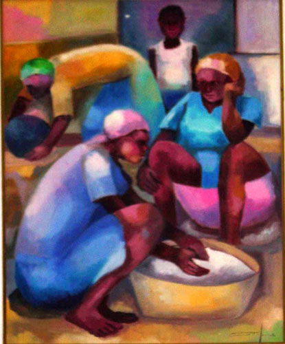
Here's some haitian art I've found on the web - I'm not saying use the images themselves (copyright) but you could sample the colors from one of them and create a palette in photoshop. What I find surprising is that the colors in each - by different artists - are remarkably similar. Lots of strong reds and blue, perhaps a nod to the Haitian flag.

Image
Image
Image
[bigimg]http://haitianartsociety.org/images/jrchery_center_h_a_society.jpg[/bigimg]
[bigimg]http://www.gmu.edu/jbc/Tyler/images/tyler2pics/IMG13.jpg[/bigimg]
Image
whitestazn88
Posts: 3128
Joined: Mon Feb 05, 2007 2:59 pm
Gender: Male
Location: behind you
Contact:

Re: Haiti v6 pg6

Post by whitestazn88 »

the legend colors and map colors don't match
User avatar
t-o-m
Posts: 2918
Joined: Sat Mar 22, 2008 2:22 pm

Re: Haiti v6 pg6

Post by t-o-m »

whitestazn88 wrote:the legend colors and map colors don't match

no they dont :roll:

:roll: umm ed you intended to do that didnt yu ;) :roll:

wow i havnt posted on this thread for yearrrsss
User avatar
Ruben Cassar
Posts: 2160
Joined: Thu Nov 16, 2006 6:04 am
Gender: Male
Location: Civitas Invicta, Melita, Evropa

Re: Haiti v6 pg6

Post by Ruben Cassar »

I'm not sure but there is something that is not convincing me 100% about the colours. They seem slightly too bright but perhaps it's part of the theme?

On a separate note you are missing the accent on the letter "o" in the word "Côtes".
ImageImageImageImageImage
User avatar
TaCktiX
Posts: 2392
Joined: Mon Dec 17, 2007 8:24 pm
Gender: Male
Location: Rapid City, SD

Re: Haiti v6 pg6

Post by TaCktiX »

With this latest version, I don't like the territory name text color. With exception of Centre, you could get away with a pure or off white (which I suggest you do). The brown-ish-thingy detracts from the map's much-improved look.
User avatar
edbeard
Posts: 2501
Joined: Thu Mar 29, 2007 12:41 am

Re: Haiti v7 pg6

Post by edbeard »

[bigimg]http://i140.photobucket.com/albums/r4/runthemover/haitiv7.png[/bigimg]


v6
v5
v4
v3
v2
v1

What you need to know:

1. 28 territories
2. 6 continents

Changes in this update
1. redid border colour scheme
a. inside continent borders made into colour of continent
b. back to black for between border continents. glow added to distinguish further from rivers

2. new colours for water routes. match the continents going to and from

3. no more army circles

4. glow added to territory label text

5. Centre changed from white to orange

6. legend colours made to be exactly like continent colours.

Tom I nvr sed I in10ded to do that. I'd always sed that there wasn8 any problem of distinguishing what went to what continent so it wasn8 a big deal to be off colour.

I liked it better before so I might go back to it.


To Do:

1. Gameplay / Bonus Discussion

2. fix Cote name. add accent per Ruben Cassar

Points of Discussion:
User avatar
TaCktiX
Posts: 2392
Joined: Mon Dec 17, 2007 8:24 pm
Gender: Male
Location: Rapid City, SD

Re: Haiti v7 pg6

Post by TaCktiX »

And now the territory names are lost at sea...different color on the ocean, I suppose. The other ones look just fine.
User avatar
edbeard
Posts: 2501
Joined: Thu Mar 29, 2007 12:41 am

Re: Haiti v7 pg6

Post by edbeard »

Responses to a few random comments:


legend 1/3 of the size of the map - actually it's 1/6


water routes - well I'm not sure about putting boats in there. How do you like the dots with the new colours?


territory names - how are they lost at sea? They are quite readable. Without the glow they are not as evident.

You might say, "hey. you can fit them on the map instead of over water." Yes. I realize this. But, some of them cannot be put onto land as there are islands and Port-au-Prince. Also, these type of things can be done when I need to add somehing to a mini-update to boost it up a bit. So shush.


You might also say, "The Bouli - Saint-Marc border is smaller at one end than another." - Yes thanks I can see this. Why don't you give me feedback on the map as a whole instead of just nitpicking? You'd respond, "that isn't fair because you're writing what I'm saying so I have no control over the feedback whatsoever." Well you shouldn't have opened your mouth. Then you'd walk away in shame with your tail between your legs.


repost for new page:
[bigimg]http://i140.photobucket.com/albums/r4/runthemover/haitiv7.png[/bigimg]
User avatar
ZeakCytho
Posts: 1251
Joined: Wed Sep 12, 2007 4:36 pm

Re: Haiti v7 pg6

Post by ZeakCytho »

I liked the old borders much better. These new ones require me to strain to accurately see them, which I don't enjoy :cry:

Also, you may have missed my comment earlier about the legend font. It's hard to read and doesn't seem to fit with the graphical style of the rest of the map at all.
User avatar
edbeard
Posts: 2501
Joined: Thu Mar 29, 2007 12:41 am

Re: Haiti v7 pg6

Post by edbeard »

I saw it. I just disagree. I meant to put it in the above post, but forgot.


I don't think the legend needs to match exactly the map itself in terms of font style. The legend is more like what someone would write out by hand.


Which borders specifically are giving you trouble. They seem fine to me so I can't fix something that I can't see.

These ones are more subtle, but when you combine that with the text and the army counts, I think it'll be clear.
User avatar
mibi
Posts: 3350
Joined: Thu Mar 01, 2007 8:19 pm
Location: The Great State of Vermont
Contact:

Re: Haiti v7 pg6

Post by mibi »

edbeard wrote:I saw it. I just disagree. I meant to put it in the above post, but forgot.


I don't think the legend needs to match exactly the map itself in terms of font style. The legend is more like what someone would write out by hand.


Which borders specifically are giving you trouble. They seem fine to me so I can't fix something that I can't see.

These ones are more subtle, but when you combine that with the text and the army counts, I think it'll be clear.


The legend blows. Its sloppy and a terrible use of space. The font is really inappropriate as well. Its borderline graf. And all the borders are unclear. I don't know what you were thinking using green borders on green land and blue borders on blue land, etc. Its pretty ridiculous.

I think I actually preferred the boring textbook style map than this half-assed Haiti-ish version.
User avatar
edbeard
Posts: 2501
Joined: Thu Mar 29, 2007 12:41 am

Re: Haiti v7 pg6

Post by edbeard »

oh well, mibi. I can't please everyone.
User avatar
Ruben Cassar
Posts: 2160
Joined: Thu Nov 16, 2006 6:04 am
Gender: Male
Location: Civitas Invicta, Melita, Evropa

Re: Haiti v7 pg6

Post by Ruben Cassar »

Font Colours: The ones on land are fine. The ones in the sea are not. They are barely legible. Perhaps removing the stroke and using a lighter colour for the font could fix the problem.

Border Colours: No go. I cannot see the borders in the green territory. The colours needs to be changed. I would consider using only 1 colour for the border lines.
ImageImageImageImageImage
User avatar
edbeard
Posts: 2501
Joined: Thu Mar 29, 2007 12:41 am

Re: Haiti v8 pg7

Post by edbeard »

[bigimg]http://i140.photobucket.com/albums/r4/runthemover/haitiv8.png[/bigimg]


v7
v6
v5
v4
v3
v2
v1

What you need to know:

1. 28 territories
2. 6 continents

Changes in this update
1. changed inside continent border colours. If I want these continent colours, I can't do the inside borders the way I wanted so I just went the simpler way like the other borders.

2. changed water routes. quite a bit smaller they are.

3. moved territory labels around. moved the ones that fit on land onto the land.

4. increased the glow of the territory label text on the water to make it more readable (hopefully).

5. added accents to the territory names. hopefully I didn't miss any

To Do:

1. Gameplay / Bonus Discussion
2. Small map

Points of Discussion

1. XML completed (except for small map coordinates).

Code: Select all

 <map>
  <title>Haiti</title>
  <smallwidth>600</smallwidth>
  <smallheight>450</smallheight>
  <largewidth>698</largewidth>
  <largeheight>517</largeheight>
  <filetype>png</filetype>

 <continent>
  <name>Nord</name>
  <bonus>3</bonus>
 <components>
  <territory>Baie de Henne</territory>
  <territory>Port-de-Paix</territory>
  <territory>Ile de la Tortue</territory>
  <territory>Le Borgne</territory>
  <territory>Limbe</territory>
  <territory>Fort-Liberte</territory>
  </components>
  </continent>

 <continent>
  <name>Artibonite</name>
  <bonus>3</bonus>
 <components>
  <territory>Gonaives</territory>
  <territory>Cammon</territory>
  <territory>Ennery</territory>
  <territory>Saint-Marc</territory>
  </components>
  </continent>

 <continent>
  <name>Centre</name>
  <bonus>2</bonus>
 <components>
  <territory>Bouli</territory>
  <territory>La Finca</territory>
  <territory>Hinche</territory>
  <territory>Lac de Peligre</territory>
  </components>
  </continent>

 <continent>
  <name>Ouest</name>
  <bonus>3</bonus>
 <components>
  <territory>Ile de la Gonave</territory>
  <territory>Montrouis</territory>
  <territory>Manneville</territory>
  <territory>Port-au-Prince</territory>
  <territory>Kenscoff</territory>
  </components>
  </continent>

 <continent>
  <name>Sud</name>
  <bonus>2</bonus>
 <components>
  <territory>Jeremie</territory>
  <territory>Les Cayes</territory>
  <territory>Pestel</territory>
  <territory>Aquin</territory>
  <territory>Cotes de Fer</territory>
  </components>
  </continent>

 <continent>
  <name>Sud-Est</name>
  <bonus>3</bonus>
 <components>
  <territory>Leogane</territory>
  <territory>Bainet</territory>
  <territory>Manneville</territory>
  <territory>Marigot</territory>
  <territory>Belle-Anse</territory>
  </components>
  </continent>

 <territory>
  <name>Baie de Henne</name>
<borders>
  <border>Port-de-Paix</border>
</borders>
 <coordinates>
  <smallx>0</smallx>
  <smally>0</smally>
  <largex>304</largex>
  <largey>108</largey>
  </coordinates>
  </territory>

 <territory>
  <name>Port-de-Paix</name>
<borders>
  <border>Baie de Henne</border>
  <border>Ile de la Tortue</border>
  <border>Cammon</border>
  <border>Gonaives</border>
</borders>
 <coordinates>
  <smallx>0</smallx>
  <smally>0</smally>
  <largex>369</largex>
  <largey>94</largey>
  </coordinates>
</territory>

 <territory>
  <name>Ile de la Tortue</name>
 <borders>
  <border>Port-de-Paix</border>
  <border>Limbe</border>
  </borders>
 <coordinates>
  <smallx>0</smallx>
  <smally>0</smally>
  <largex>404</largex>
  <largey>51</largey>
  </coordinates>
  </territory>

 <territory>
  <name>Le Borgne</name>
 <borders>
  <border>Limbe</border>
  </borders>
 <coordinates>
  <smallx>0</smallx>
  <smally>0</smally>
  <largex>440</largex>
  <largey>100</largey>
  </coordinates>
  </territory>

 <territory>
  <name>Limbe</name>
 <borders>
  <border>Le Borgne</border>
  <border>Ile de la Tortue</border>
  <border>Fort-Liberte</border> 
  <border>Ennery</border>
  </borders>
 <coordinates>
  <smallx>0</smallx>
  <smally>0</smally>
  <largex>517</largex>
  <largey>128</largey>
  </coordinates>
  </territory>

 <territory>
  <name>Fort-Liberte</name>
 <borders>
  <border>Limbe</border>
  <border>La Finca</border>
  </borders>
 <coordinates>
  <smallx>0</smallx>
  <smally>0</smally>
  <largex>586</largex>
  <largey>179</largey>
  </coordinates>
  </territory>

 <territory>
  <name>Gonaives</name>
 <borders>
  <border>Port-de-Paix</border>
  <border>Cammon</border>
  <border>Ennery</border>
  </borders>
 <coordinates>
  <smallx>0</smallx>
  <smally>0</smally>
  <largex>382</largex>
  <largey>147</largey>
  </coordinates>
  </territory>

 <territory>
  <name>Cammon</name>
 <borders>
  <border>Port-de-Paix</border>
  <border>Gonaives</border>
  <border>Ennery</border>
  </borders>
 <coordinates>
  <smallx>0</smallx>
  <smally>0</smally>
  <largex>440</largex>
  <largey>156</largey>
  </coordinates>
  </territory>

 <territory>
  <name>Ennery</name>
 <borders>
  <border>Gonaives</border>
  <border>Cammon</border>
  <border>Limbe</border>
  <border>Saint-Marc</border>
  <border>Bouli</border>
  </borders>
 <coordinates>
  <smallx>0</smallx>
  <smally>0</smally>
  <largex>464</largex>
  <largey>179</largey>
  </coordinates>
  </territory>

 <territory>
  <name>Saint-Marc</name>
 <borders>
  <border>Ennery</border>
  <border>Bouli</border>
  <border>Ile de la Gonave</border>
  </borders>
 <coordinates>
  <smallx>0</smallx>
  <smally>0</smally>
  <largex>470</largex>
  <largey>225</largey>
  </coordinates>
  </territory>

 <territory>
  <name>Bouli</name>
 <borders>
  <border>Ennery</border>
  <border>Saint-Marc</border>
  <border>Manneville</border>
  <border>Hinche</border>
  </borders>
 <coordinates>
  <smallx>0</smallx>
  <smally>0</smally>
  <largex>530</largex>
  <largey>265</largey>
  </coordinates>
  </territory>

 <territory>
  <name>La Finca</name>
 <borders>
  <border>Fort-Liberte</border>
  <border>Hinche</border>
  </borders>
 <coordinates>
  <smallx>0</smallx>
  <smally>0</smally>
  <largex>576</largex>
  <largey>230</largey>
  </coordinates>
  </territory>

 <territory>
  <name>Hinche</name>
 <borders>
  <border>Bouli</border>
  <border>La Finca</border>
  <border>Lac de Peligre</border>
  </borders>
 <coordinates>
  <smallx>0</smallx>
  <smally>0</smally>
  <largex>568</largex>
  <largey>268</largey>
  </coordinates>
  </territory>

 <territory>
  <name>Lac de Peligre</name>
 <borders>
  <border>Hinche</border>
  </borders>
 <coordinates>
  <smallx>0</smallx>
  <smally>0</smally>
  <largex>606</largex>
  <largey>318</largey>
  </coordinates>
  </territory>

 <territory>
  <name>Ile de la Gonave</name>
 <borders>
  <border>Montrouis</border>
  <border>Saint-Marc</border>
  <border>Leogane</border>
  <border>Pestel</border>
  </borders>
 <coordinates>
  <smallx>0</smallx>
  <smally>0</smally>
  <largex>350</largex>
  <largey>313</largey>
  </coordinates>
  </territory>

 <territory>
  <name>Montrouis</name>
 <borders>
  <border>Ile de la Gonave</border>
  <border>Manneville</border>
  </borders>
 <coordinates>
  <smallx>0</smallx>
  <smally>0</smally>
  <largex>465</largex>
  <largey>300</largey>
  </coordinates>
  </territory>

 <territory>
  <name>Manneville</name>
 <borders>
  <border>Montrouis</border>
  <border>Bouli</border>
  <border>Port-au-Prince</border>
  <border>Kenscoff</border>
  </borders>
 <coordinates>
  <smallx>0</smallx>
  <smally>0</smally>
  <largex>523</largex>
  <largey>340</largey>
  </coordinates>
  </territory>

 <territory>
  <name>Port-au-Prince</name>
 <borders>
  <border>Manneville</border>
  <border>Kenscoff</border>
  </borders>
 <coordinates>
  <smallx>0</smallx>
  <smally>0</smally>
  <largex>503</largex>
  <largey>387</largey>
  </coordinates>
  </territory>

 <territory>
  <name>Kenscoff</name>
 <borders>
  <border>Manneville</border>
  <border>Port-au-Prince</border>
  <border>Marigot</border>
  <border>Belle-Anse</border>
  </borders>
 <coordinates>
  <smallx>0</smallx>
  <smally>0</smally>
  <largex>549</largex>
  <largey>395</largey>
  </coordinates>
  </territory>


 <territory>
  <name>Jeremie</name>
 <borders>
  <border>Pestel</border>
  <border>Les Cayes</border>
  </borders>
 <coordinates>
  <smallx>0</smallx>
  <smally>0</smally>
  <largex>140</largex>
  <largey>390</largey>
  </coordinates>
  </territory>

 <territory>
  <name>Les Cayes</name>
 <borders>
  <border>Jeremie</border>
  <border>Pestel</border>
  <border>Aquin</border>
  </borders>
 <coordinates>
  <smallx>0</smallx>
  <smally>0</smally>
  <largex>180</largex>
  <largey>450</largey>
  </coordinates>
  </territory>

 <territory>
  <name>Pestel</name>
 <borders>
  <border>Jeremie</border>
  <border>Les Cayes</border>
  <border>Aquin</border>
  <border>Ile de la Gonave</border>
  </borders>
 <coordinates>
  <smallx>0</smallx>
  <smally>0</smally>
  <largex>188</largex>
  <largey>388</largey>
  </coordinates>
  </territory>

 <territory>
  <name>Aquin</name>
 <borders>
  <border>Pestel</border>
  <border>Les Cayes</border>
  <border>Cotes de Fer</border>
  </borders>
 <coordinates>
  <smallx>0</smallx>
  <smally>0</smally>
  <largex>220</largex>
  <largey>422</largey>
  </coordinates>
  </territory>

 <territory>
  <name>Cotes de Fer</name>
 <borders>
  <border>Aquin</border>
  <border>Leogane</border>
  <border>Bainet</border>
  </borders>
 <coordinates>
  <smallx>0</smallx>
  <smally>0</smally>
  <largex>330</largex>
  <largey>413</largey>
  </coordinates>
  </territory>

 <territory>
  <name>Leogane</name>
 <borders>
  <border>Cotes de Fer</border>
  <border>Ile de la Gonave</border>
  <border>Bainet</border>
  <border>Marigot</border>
  </borders>
 <coordinates>
  <smallx>0</smallx>
  <smally>0</smally>
  <largex>438</largex>
  <largey>408</largey>
  </coordinates>
  </territory>

 <territory>
  <name>Bainet</name>
 <borders>
  <border>Cotes de Fer</border>
  <border>Leogane</border>
  <border>Marigot</border>
  </borders>
 <coordinates>
  <smallx>0</smallx>
  <smally>0</smally>
  <largex>430</largex>
  <largey>445</largey>
  </coordinates>
  </territory>

 <territory>
  <name>Marigot</name>
 <borders>
  <border>Belle-Anse</border>
  <border>Kenscoff</border>
  <border>Leogane</border>
  <border>Bainet</border>
  </borders>
 <coordinates>
  <smallx>0</smallx>
  <smally>0</smally>
  <largex>470</largex>
  <largey>430</largey>
  </coordinates>
  </territory>

 <territory>
  <name>Belle-Anse</name>
 <borders>
  <border>Marigot</border>
  <border>Kenscoff</border>
  </borders>
 <coordinates>
  <smallx>0</smallx>
  <smally>0</smally>
  <largex>598</largex>
  <largey>452</largey>
  </coordinates>
  </territory>

  </map>


[bigimg]http://i140.photobucket.com/albums/r4/runthemover/haitivxml1.png[/bigimg]


Image
User avatar
Ruben Cassar
Posts: 2160
Joined: Thu Nov 16, 2006 6:04 am
Gender: Male
Location: Civitas Invicta, Melita, Evropa

Re: Haiti v8 pg7

Post by Ruben Cassar »

Great update. Looking very good.

The only things I still don't like are the text on the sea and the font used for the legend.

As I said in the earlier post I think you should remove the stroke and use a lighter colour for the sea text.

I don't like the font used in the legend, it does not seem to fit with the rest of the map.
ImageImageImageImageImage
User avatar
edbeard
Posts: 2501
Joined: Thu Mar 29, 2007 12:41 am

Re: Haiti v8 pg7

Post by edbeard »

Ruben Cassar wrote:Great update. Looking very good.

The only things I still don't like are the text on the sea and the font used for the legend.

As I said in the earlier post I think you should remove the stroke and use a lighter colour for the sea text.

I don't like the font used in the legend, it does not seem to fit with the rest of the map.


thanks.

1. sea text - is it totally illegible? I could try using white text on the water I guess.

2. I like the legend. It's as if someone actually wrote it out so I don't think the font needs to be similar to the rest of the map.
User avatar
Ruben Cassar
Posts: 2160
Joined: Thu Nov 16, 2006 6:04 am
Gender: Male
Location: Civitas Invicta, Melita, Evropa

Re: Haiti v8 pg7

Post by Ruben Cassar »

edbeard wrote:
Ruben Cassar wrote:Great update. Looking very good.

The only things I still don't like are the text on the sea and the font used for the legend.

As I said in the earlier post I think you should remove the stroke and use a lighter colour for the sea text.

I don't like the font used in the legend, it does not seem to fit with the rest of the map.


thanks.

1. sea text - is it totally illegible? I could try using white text on the water I guess.

2. I like the legend. It's as if someone actually wrote it out so I don't think the font needs to be similar to the rest of the map.


1. Yes can you try that? The important thing is removing the stroke or changing its thickness or glow perhaps.

2. That's okay. It's a matter of personal taste. There's nothing wrong with it and if you like the way it is then so be it. A map maker needs to make his own creative decisions as well. After all that's what gives a map that personal touch.

Looking forward to play on this one. I noticed you fixed all the accents as well. Great.
ImageImageImageImageImage
Post Reply

Return to “The Atlas”