Page 16 of 39
Posted: Sun Dec 23, 2007 11:22 am
by gimil
Posted: Sun Dec 23, 2007 4:00 pm
by Bad Speler
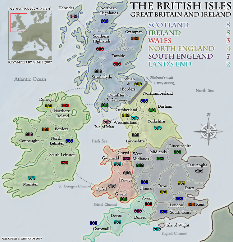
Nice wall.
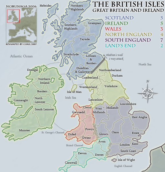
My only complaint is can you make the 1 way attack font darker on the small map? It's hard to read on my computer.
Posted: Sun Dec 23, 2007 4:09 pm
by lanyards
Bad Speler wrote:My only complaint is can you make the 1 way attack font darker on the small map? It's hard to read on my computer.
I agree, make all the text naming the seas, channels, oceans, and the text that says "Hadrian's Wall 1 Way Attack" a little bit darker, like the color of Hadrian's Wall. I suggest doing it on both the large and small map, just to stay consistent. Nice job on the wall.
--lanyards
Posted: Sun Dec 23, 2007 4:18 pm
by gimil
I will look into these guys thanks

Posted: Sun Dec 23, 2007 4:24 pm
by Balsiefen
lanyards wrote:Bad Speler wrote:My only complaint is can you make the 1 way attack font darker on the small map? It's hard to read on my computer.
I agree, make all the text naming the seas, channels, oceans, and the text that says "Hadrian's Wall 1 Way Attack" a little bit darker, like the color of Hadrian's Wall. I suggest doing it on both the large and small map, just to stay consistent. Nice job on the wall.
--lanyards
If that doesn't look good you could always make the text there larger (I have a feeling that could be more effective, but if darker works then fine)
Posted: Sun Dec 23, 2007 8:04 pm
by gimil
Posted: Sun Dec 23, 2007 8:08 pm
by Bad Speler
Much better...for me, the three channels at the bottom on the small map are still hard to read, but thats not important.
Posted: Sun Dec 23, 2007 8:11 pm
by gimil
Bad Speler wrote:Much better...for me, the three channels at the bottom on the small map are still hard to read, but thats not important.
remeber there jsut decoration and not actually there to be read

Posted: Sun Dec 23, 2007 8:56 pm
by AndyDufresne
Nice logic.

hehe. It's looking pleasantly spectacular.
--Andy
Posted: Sun Dec 23, 2007 8:57 pm
by gimil
AndyDufresne wrote:Nice logic.
hehe. It's looking pleasantly spectacular.
--Andy
WELL. . .
what are you waiting for
Posted: Sun Dec 23, 2007 10:04 pm
by lanyards
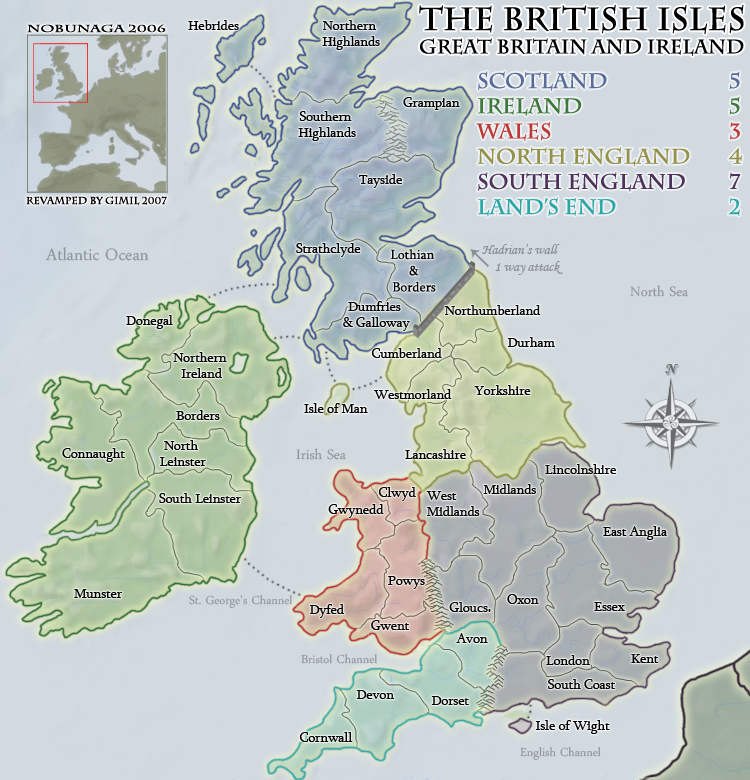
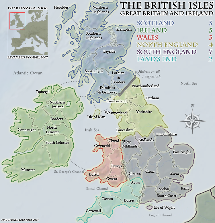
Just a suggestion, but I think it would help to make the border between Westmorland and Durham more seeable.
--lanyards
Posted: Sun Dec 23, 2007 10:10 pm
by gimil
next updat eill fix it
Posted: Sun Dec 23, 2007 10:37 pm
by gimil
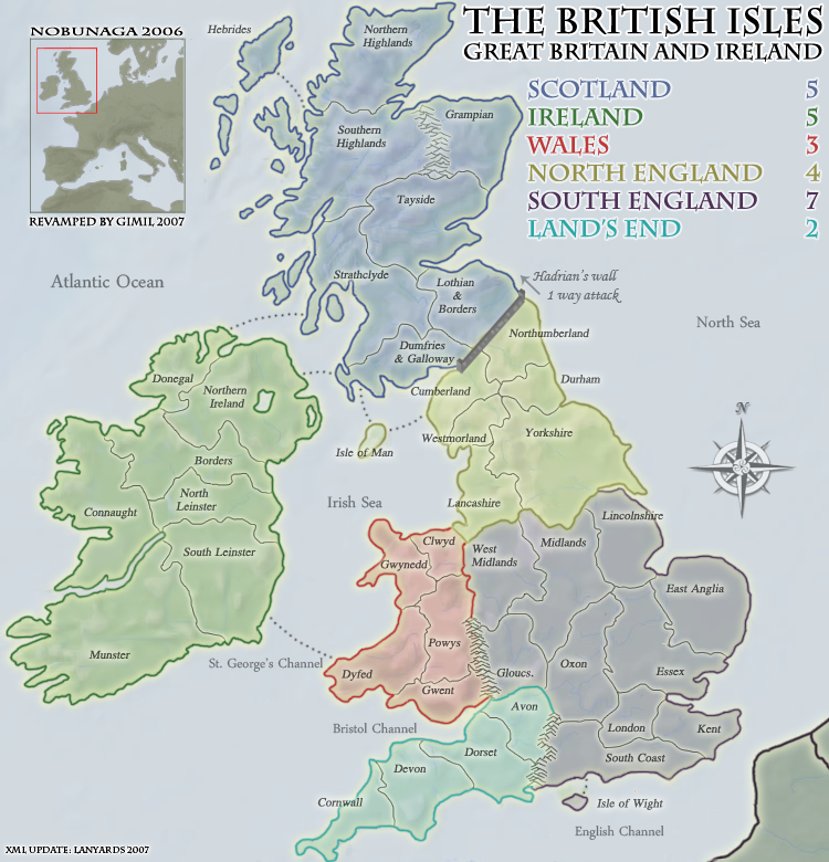
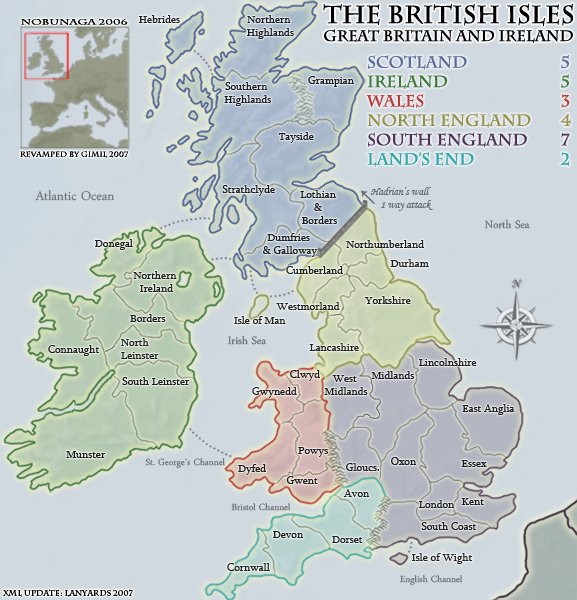
I think lanyards is going to post my next update with his updates XML with both 88 & 888 coordinates
Posted: Mon Dec 24, 2007 1:35 am
by lanyards
Gimil has given me the privilege of posting the next updates, along with the XML coordinates test. Here they are:
Small:
Small Test 88:
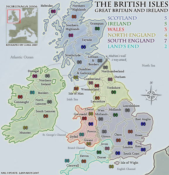
Small Test 888:
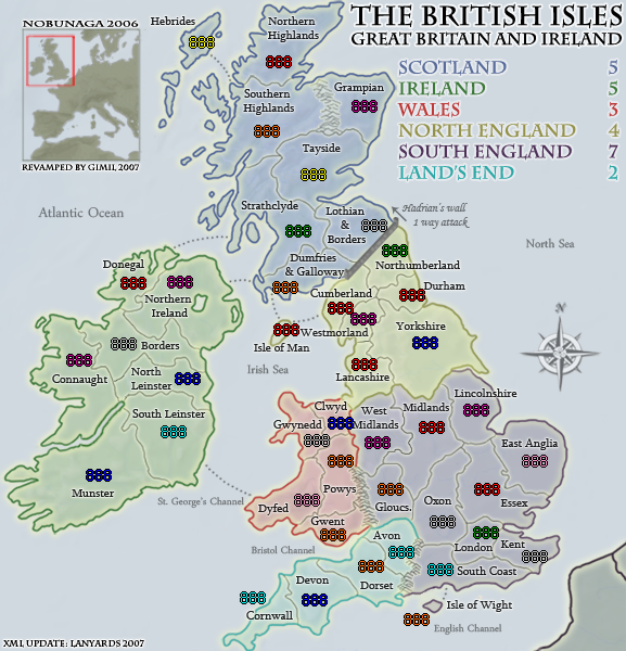
Large:
Large Test 88:
Large Test 888:
The XML is done and tested.
--lanyards
Posted: Mon Dec 24, 2007 1:36 am
by lanyards
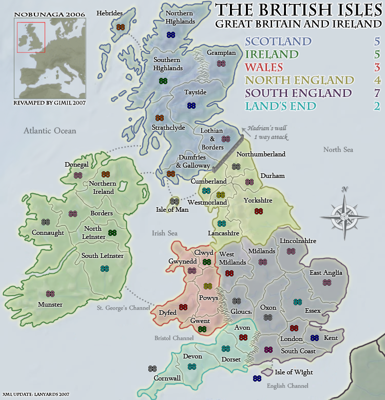
Some of the territory names still need to be moved around to make room for the army count.
--lanyards
Posted: Mon Dec 24, 2007 2:25 am
by Night Strike
Cornwall and Isle of Wright need some fixes on the small map (as you probably know).
A couple of territory names, Donegal and Clywd stood out, seem to blend with the thick continent border too much. See if those can be clarified.
(By the way, I only use small maps, which is why I'm just paying attention to it.)
Posted: Mon Dec 24, 2007 9:24 am
by gimil
Cant see the coodniates result, ill need to wait for the XML getting sent over before i can get the next update done.
Posted: Mon Dec 24, 2007 10:41 am
by lanyards
gimil wrote:Cant see the coodniates result, ill need to wait for the XML getting sent over before i can get the next update done.
Do they show up now? I switched to Photobucket and they seem to be showing up.
--lanyards
Posted: Mon Dec 24, 2007 10:47 am
by gimil
lanyards wrote:gimil wrote:Cant see the coodniates result, ill need to wait for the XML getting sent over before i can get the next update done.
Do they show up now? I switched to Photobucket and they seem to be showing up.
--lanyards
no i mean the images wont show at all on my comp, my cache wont load them for some reason.
Posted: Mon Dec 24, 2007 10:50 am
by lanyards
This might be hard to see, but between Isle of Wight and South Coast there is a greenish shape. It is only on the large map.
--lanyards
Posted: Mon Dec 24, 2007 10:57 am
by gimil
lanyards wrote:This might be hard to see, but between Isle of Wight and South Coast there is a greenish shape. It is only on the large map.
--lanyards
aw yes i see it. Ill fix it after you send over the XML
Posted: Mon Dec 24, 2007 12:41 pm
by lord voldemort
im liking it gimil...
first thought though donegal territory name, could it be place either outside the border its hard to read on the small map...the large seams fine...not sure if this was discussed earlier in the thread
Posted: Mon Dec 24, 2007 12:49 pm
by gimil
lord voldemort wrote:im liking it gimil...
first thought though donegal territory name, could it be place either outside the border its hard to read on the small map...the large seams fine...not sure if this was discussed earlier in the thread
Ive jsut revamped all hte terr names update here in seconds . . .
Posted: Mon Dec 24, 2007 12:50 pm
by gimil
Posted: Mon Dec 24, 2007 1:22 pm
by lord voldemort
its mainly donegal on the small that bothers me, with the border...