The Texan Wars [Quenched]
Moderator: Cartographers
Forum rules
Please read the Community Guidelines before posting.
Please read the Community Guidelines before posting.


-
wcaclimbing

- Posts: 5598
- Joined: Fri May 12, 2006 10:09 pm
- Location: In your quantum box....Maybe.
- Contact:

-
DiM

- Posts: 10415
- Joined: Wed Feb 14, 2007 6:20 pm
- Gender: Male
- Location: making maps for scooby snacks
the barbed wire has already been mentioned by a few people and from what i understand he'll work on it as well as other things. have patience until the next update.
“In the beginning God said, the four-dimensional divergence of an antisymmetric, second rank tensor equals zero, and there was light, and it was good. And on the seventh day he rested.”- Michio Kaku
Map's looking great!
A couple suggestions...
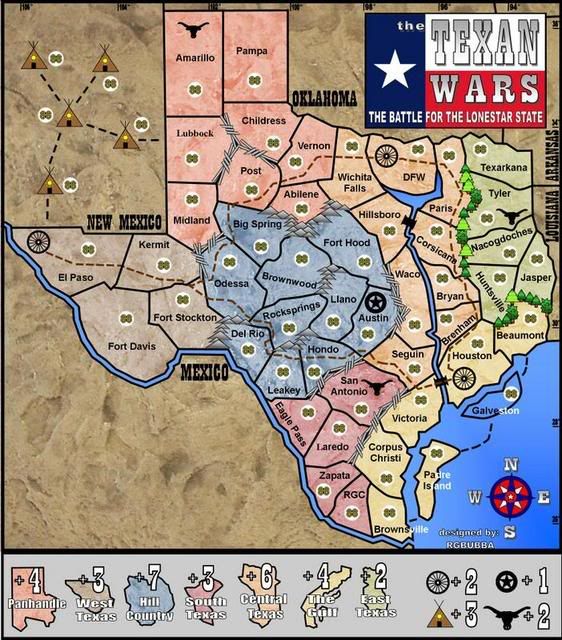
There's really no time-era on this anywhere, but one can assume that, with the tee-pee's, that this would be perhaps late 1800's (?) and during that time Oklahoma was considered Indian Teritory.
Might it be an idea to place a couple of the tee-pee's in OK?
Also, maybe spelling out Dallas-Fort Worth rather than DFW?
A couple suggestions...
There's really no time-era on this anywhere, but one can assume that, with the tee-pee's, that this would be perhaps late 1800's (?) and during that time Oklahoma was considered Indian Teritory.
Might it be an idea to place a couple of the tee-pee's in OK?
Also, maybe spelling out Dallas-Fort Worth rather than DFW?
Re: NEW MAP
rgbubba wrote:I added Bounse!!!
Only a few minor complaints on another wise great map.
Odessa is actually situated north of Midland, and there is really no mountains around their either...try barbed wire...it is really on the edwards plateau...i live here so thats why i know
Otherwise awesome map
Re: NEW MAP
bspride wrote:
Only a few minor complaints on another wise great map.
Odessa is actually situated north of Midland, and there is really no mountains around their either...try barbed wire...it is really on the edwards plateau...i live here so thats why i know
Otherwise awesome map
Thanks I will do that!


-
Jesus_Is_Life

- Posts: 2
- Joined: Fri Jul 13, 2007 9:27 am
- Location: Texas
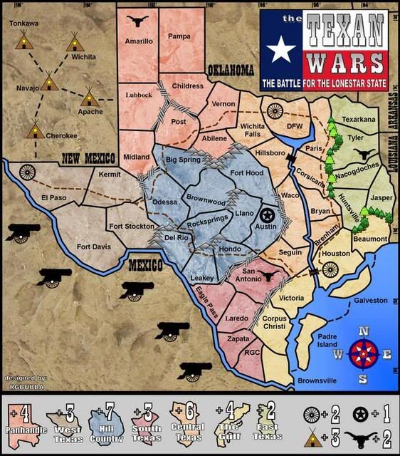
rgbubba wrote:Unit_2 wrote:what are the names for the camps?
I don't know yet, but if you have a suggestion please do so.
Try naming them after indian tribes.
I would suggest using:
Navajo, Apache, Tonkawa, Wichita, and Cherokee
qwert wrote:Well i must say that you must put to names been in one colours(Brounsville-Padre island-Galveston)
I agree with this completely, it's hard to read.
-
reverend_kyle

- Posts: 9250
- Joined: Tue Mar 21, 2006 4:08 pm
- Location: 1000 post club
- Contact:
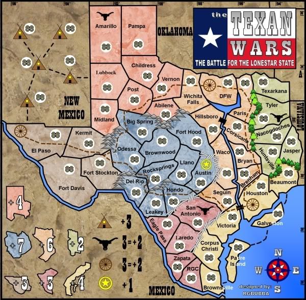
NEW MAP 12-2-07
I added Canons! Please suggest bonus point for them. Thanks!!!
Added canons.
Please address any problem areas that you may have.
Thank You.
Thank You.


