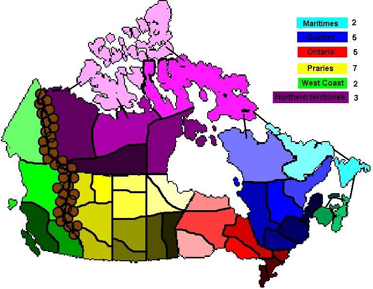
yeesh! That was my first version. Its ugly, but with that started a lot of thinking and work.
Keep working on your ideas!
Moderator: Cartographers
![]() by supermarcol on Sat Mar 18, 2006 8:38 pm
by supermarcol on Sat Mar 18, 2006 8:38 pm


![]() by DublinDoogey on Sat Mar 18, 2006 10:42 pm
by DublinDoogey on Sat Mar 18, 2006 10:42 pm


![]() by superman on Mon Mar 20, 2006 5:06 pm
by superman on Mon Mar 20, 2006 5:06 pm
![]() by DublinDoogey on Mon Mar 20, 2006 11:02 pm
by DublinDoogey on Mon Mar 20, 2006 11:02 pm
![]() by thegrimsleeper on Tue Mar 21, 2006 1:54 pm
by thegrimsleeper on Tue Mar 21, 2006 1:54 pm

Users browsing this forum: No registered users
|
|||||||
| Conquer Club is not associated with RISK online in any way. Copyright © 2006-2025 by Big Wham LLC | |||||||